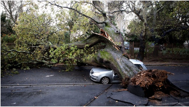
SA weather service forecasts severe, damaging winds along the Western Cape coastline
Written by CCFM on November 24, 2021
SA weather service forecasts severe, damaging winds along the Western Cape coastline

Cape Town – The South African Weather Service (SAWS) has issued a series of severe weather alerts about damaging winds causing difficulty in navigation at sea due to rough and choppy conditions and the possibility of development and spread of runway fires all along the Western Cape coastline over the next few days.
SAWS alerted the public to a Yellow Level 2 warning, which means heavy rains are expected, and flooding is possible, and the public should monitor weather conditions.
SAWS has also forecast coastal wind resulting in localised disruption of small harbours and/or a port for a short period of time is expected between Cape Columbine and Gansbaai on Wednesday.
In the Saldanha Bay/Langebaan areas, SAWS has issued its most severe alert for South Africa, a Level 10 weather warning, and has warned of veld fire conditions on Thursday morning from 7am to 10am.
SAWS forecast that conditions are such that the Fire Danger Index (FDI) is above 75. SAWS said that under these conditions, fires could develop and spread rapidly, resulting in damage to property and possible loss of human and/or animal life.
The intense weather system will result in a strong to gale force south-east to easterly force wind between 60 to 70km/h or gusting 80 to 100 km/h between Saldanha Bay and Plettenberg Bay.
The weather conditions are expected to spread to the Garden Route by Friday, and the weather service has warned that small boats must stay away from open seas.
Meanwhile, a cut-off low pressure system is expected to affect the Namakwa District of Northern Cape and Western Cape from Thursday into Saturday.
SAWS has advised the public and small stock farmers to be alert and follow the latest weather forecasts as there is a risk of some local disruptions due to strong winds (both coastal and inland), very rough seas and widespread thundershowers over the period.
SAWS said fire teams, labour and equipment are to be placed on stand-by. “At the first sign of smoke, every possible measure should be taken in order to bring the fire under control in the shortest possible time.
Meanwhile, Cape Town’s dam levels have fallen for the fourth consecutive time since the beginning of November when the capacity of dams supplying the Cape Town metro fell to 100% from 100.5% on October 25.
The City reports the dams are now standing at 97.7% having dropped by 1.1% the last week, from 98.8%. At the same time last year, dam levels were at 98.8%.
Meanwhile, Cape Town’s dam levels have fallen for the fourth consecutive time since the beginning of November when the capacity of dams supplying the Cape Town metro fell to 100% from 100.5% on October 25.
The City reports the dams are now standing at 97.7%, having dropped by 1.1% the last week, from 98.8%. At the same time last year, dam levels were at 98.8%.
At the same, time despite the misery brought about by the floods in the Southern Cape, national Department of Water and Sanitation spokesperson Sputnik Ratau reported that dams in the region are overflowing.
“The Garden Route dam has received 112mm of rain and is already spilling. By noon on Monday, the dam, which supplies drinking water to the town of George, had received 139mm already.
“The other significant dam in the area is the Wolwedans dam. The dam supplies water to the Mossel Bay Municipality and PetroSA. The catchment of the Wolwedans dam has received 85mm rainfall.
“At the bottom of the Wolwedans dam is the Groot Brak estuary, where people live in the flood line.
“Last Wednesday, November 17, the Groot Brak estuary was breached to prevent flooding,” Ratau said.
He said had the estuary not been breached, there would have been serious flooding of the Groot Brak town.


